Monday, 22 September 2014

Dream Boat

Technically it's a float house, not a dream boat but that's beside the point. Whatever you want to call it, it is still one of the coolest places I've ever been. I can't disclose the location of this cabin but I will say it's on a Lake on Vancouver Island. We heard about it through a friend of a friend and decided we had to check it out for ourselves so we borrowed 2 canoes, loaded up our vehicles and set off.

After about an hour of driving, we pulled off the road into a small dirt clearing and launched our canoes. It was a beautiful sunny day and we weren't exactly sure where we were going so we took our time and enjoyed being out on the lake. The float house is situated between two islands and is hidden from view until you're very close to it.  After about an hour of paddling we managed to find it and all our expectations were surpassed.

The tiny cabin sits right off the edge of an island and there's a deck/dock out the front and some other smaller floating docks. Inside are two big beds, a table, chairs, wood-stove, and a little area equipped with anything you could ever need (for a few days at least). Pots and pans hung on the walls as well as photos and Old Lucky Lager Ads. Outside there was also a working BBQ and a battery-operated radio that just so happened to be set on the best oldies rock station.

Besides a short canoe trip to watch the sunset, we just hung out at the cabin the rest of the day. I have no idea who owns this float house, but there was a guest-book to sign so whoever is responsible for building this paradise is kind enough to let others use it (as long as they leave it as they found it). So if you ever do find it please leave it in good condition so that I can go back and enjoy it again !
just around the river bend...

~dream boat~


Tuesday, 16 September 2014

Vargas Island

We're not in Kansas anymore

Vargas is an Island just a 10 minute boat ride away from Tofino. Rumour had it that there was a beach you could sometimes surf at when the conditions were right, so 6 of us decided to spend the night there to celebrate a friends birthday. Since the guys were all bringing surfboards they boated straight to the beach where we were going to camp. However, there wasn't enough room for all of us in the boat so they dropped myself and 2 other girls off on the other side of the Island and made us hike there (we didn't really mind...).

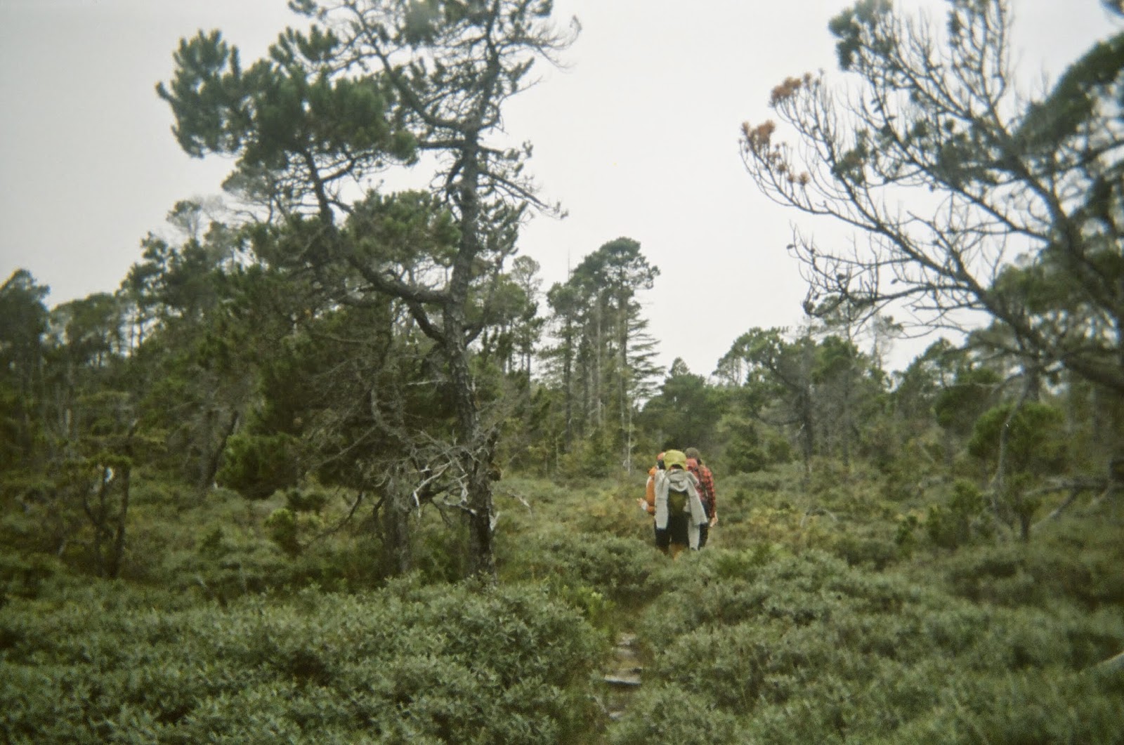
A small wooden sign reading 'Ahous Bay' marked the trail-head so we cracked some ciders and embarked on our adventure. The trail takes you to the other side of the island but you go through so many different types of eco-systems and vegetation. It is really beautiful. There are warnings of wolves on Vargas so we were a bit spooked at times but luckily had no encounters. About an hour later after walking through bogs, boardwalks, wooden bridges and bushwhacking we arrived on a deserted beach.

The only instructions we'd been given were to keep walking right along the beach and then look for hanging buoys in trees that marked the connecting trails. The three of us continued our trek for another 2 hours. Alternating between walking along wild beaches to weaving though thick overgrown trails, crawling under fallen trees and climbing over intricate root systems. Eventually, a little tipsy, we arrived at our destination and saw that the boys were already surfing.

The rest of the trip was very dreamy but basically this is what happened :  we ate, we drank, we explored, we saw a sunset that lasted for hours, we got buzzed by a float plane, had a bonfire and went skinny dipping in phosphorescence.  A lot of other amazing things happened that day and continued into the night but me explaining them wont do any justice... you'll just have to experience Vargas for yourself ;)
trippytree

pathway to paradise


meeting new friends along the way

Sunday, 14 September 2014

Lone Cone

This past summer I was fortunate enough to live (and work) in Tofino, a place with no shortage of camping or hiking spots. One of these hiking trails takes you to the top of a Mountain called Lone Cone. You can actually see it jutting out of Meares Island when you look across the inlet from town. Once you get to the top of Lone Cone you are supposed to get a beautiful view of Tofino and the surrounding area.

All summer long my friends and I talked about hiking it and we finally got organised to do it at the end of August or "Fogust". This summer the weather had been quite pleasant and the fog would usually burn off by mid-day (if there was any). The particular day we'd planned to hike it was foggier than usual, but it was our only chance and we were optimistic that the fog would be gone once we got to the top. The 7 of us chartered a boat for $30 each and it took us across to Meares Island. When we got to the Lone Cone dock we followed red flag tape to the trail entrance. The beginning of the trail was pleasant enough, we traversed through a boggy area on makeshift boardwalks and beautiful greenery. But then the trail started to go up, and up and up and up... I won't go into much detail because I don't want to discourage anyone but it is a very steep trail.

After 2 or so hours we finally made it to the top but to our dismay the fog was still there. We were literally surrounded by a white wall. Still hoping the fog would lift we ate our snacks and tried to stay occupied. Unfortunately after 2 hours of waiting the fog had still not budged so we packed up and headed down the Mountain. My legs were shaking the whole way down but finally we made it to the bottom and took the boat back to town where we celebrated with Tacofino and a group nap. I would definitely recommend Lone Cone as a hike if you're up for a challenge but make sure you do it on a clear day !

Trail to Lone Cone


"View" from the top

Saturday, 10 May 2014

Four Lanes

I took a trip to Tofino last week to visit some friends and while we were there we went camping.
The place we went is called four lanes and is not an offical camping area. From Tofino you drive back towards Nanaimo about 30 minutes and then you take a right on to an old logging road for a few minutes and then you end up at the bridge. It was a bit too cold to jump in when we went but usually people jump off. From the bridge you can see the camping area or "gravel pit''. To get to the camping spot from the bridge you probably need a car with four-wheel drive. I took my moms Suzuki and somehow made it but there are definitley some sketchy parts...
Once you make it to the camping area you get an amazing view of the bridge and a small swimming area. This is not a well known spot so pretty much anything goes once you get there. Anyways I shouldn't say anymore or else this spot might not be such a secret the next time I go back !

weenies in bikins

Saturday, 19 April 2014

Joffre Lakes Trail

~ nota bene : one of the three beautiful Joffre Lakes is depicted in my blog background ~
This day hike takes about 4 hours return and takes you up into the alpine of Joffre Lakes Provincial Park.
I did this hike last summer with a couple of friends from Whistler. It's a bit of a drive to get there (especially if you're leaving from Vancouver like I was) but the 3 lakes are stunning!  
The trail head is off of the Duffey Lake Road, past Pemberton, on the way to Lillooet.
As soon as you enter and walk a few minutes you get a view of the first lake.
It's really worth it to hike to the third though and you can stop and have a swim in the second if you're brave enough...however these are glacier fed lakes so the water is LITERALLY breathtaking.
This hike had some steep sections and it's a bit of a workout but my friend who came with me was extremely hungover and made it so I'm sure you can too.
There are camping areas around the third lake so if you're willing to carry all of your gear up to the top you are rewarded with million-dollar-view camping spot.
Also, the day we went there were mad bugs so I'd recommend some bug spray!
Middle Joffre Lake


quick dip

Tuesday, 8 April 2014

Keyhole Hot Springs

Meager Creek used to be the well known Hot Springs out past Pemberton.
Unfortunately there was a landslide a few years back that destroyed the road so they are no longer accessible.  However, if you drive a few kilometres further you will find a trail to the lesser known Keyhole Hot Springs.

It was a very rainy day but my sister and our friend Maria had heard rumours of these Hot Springs and were determined to find them. Another friend, Sean, met us in Pemberton and the 4 of us squished in my car and headed North.
It took us a few tries but eventually we found the logging road that led to the Hot Springs and followed it for about 40km.
Finally we made it to the "parking lot" and quickly unloaded the car and followed the markers toward the camping area.
The hike got VERY steep VERY fast.
Luckily we were wearing backpacks but all of us bailed down the sketchy trail at least once. Maybe it would've been easier if we weren't holding a beer in one hand but we had priorities...
By the time we had found a camping spot and set up our tent it was dark but the the 4 of us decided to go to the Hot Springs anyways.
It was another 20-30 minute steep, slippery trek but we found them.
The rain subsided and we had quite a few celebratory beers in the natural Hot Springs before heading back to our tent.
Getting back proved to be even more difficult then finding the Hot Springs and we got lost in the dark more then once but we managed to make it back and started a fire to warm up.
Sean had told some friends to come to the Hot Springs earlier but he hadn't talked to them for hours and there was no service where we were so we figured they'd given up.
However, at around midnight we heard some voices in the woods and then some guys calling "Sean!".
We couldn't believe it, they had actually found us.
It was hard enough hiking down that trail and finding our spot in the day but somehow they'd managed to do it in the pitch black.
On top of that, they'd brought a huge cooler full of beer and even a Military sized tent with them (which they ended up ditching halfway down because it was too hard for them to carry).
We all continued drinking around the fire in the rain and eventually the 7 of us piled into the 4-man tent and passed out.
The next day we went for a second soak in the Hot Springs and then basically climbed the whole way back to our cars and headed home.
This definitely wasn't one of the easiest overnight trips I've been on, but it was one of the most memorable.
If you're willing to work for it, Keyhole Hot Springs is a great place to get away.
Maria making the journey back from the Hotsprings

Keyhole Hotsprings and the Lillooet River

Wednesday, 2 April 2014

Long Way Home - Singing Pass

Last weekend my Dad invited me up to Whistler for the day. 
We got some fresh laps on Peak but by mid-day everything was tracked so we decided to hike up Flute.
To get to Flute you head right off of Symphony Chairlift and then hike for about 30-45 minutes.
It's definitely worth the effort because once you're at the top you can go down any untouched face and then it's only a short way back to Symphony Chairlift.

This particular day however, my dads friend suggested we go right, down into Singing Pass, instead of going left down Flute like usual.
I was unaware of the journey necessary to make it back to the village once you get into Singing Pass so I went along with them.
The ride down was great, 30cm of fresh snow all to ourselves. 
Once we got to the bottom we began following a cross-country-esque single-track trail.
If you're on skis (like my dad and his friends were) this trail is not to difficult. I however, was on a snowboard so had to push myself with one foot strapped in along this narrow path.
At first it was okay because we were in a beautiful, secluded area surrounded by mossy snow covered trees and I figured the hardest part would be over soon.
It wasn't.
Over an hour had passed and I was still pushing along this single track, legs burning, cursing my dad with every step.

Eventually (11km later) we made it back to Whistler Village and headed straight to the GLC for burgers and beer.

As we were taking off our equipment two skiers showed up and said "Oh man were you the snowboarder who came back from singing pass? We saw the footprints and couldn't believe it ! "

Neither could I.
Trail back from Singing Pass

Friday, 28 March 2014

Dog Mountain

A very nice hike in both summer and winter (and spring and fall) is Dog Mountain up Seymour.
The entrance is at the far end of the parking lot near mystery chairlift.
It's about a 40 minute hike in the summer and maybe 30 minutes in the winter...
Once you get to the Dog mountain lookout you can see all of Vancouver and the surrounding mountains.
Not too shabby.
Me and my dawgz heading up Dog Mountain

Wednesday, 26 March 2014

BILL 4

This must be stopped !
http://www.vancouverobserver.com/news/bill-4-passes-opens-bc-parks-industry

Canada Day at Cat Lake

Determined to go on a Canada Day Camping trip despite the rain, two girlfriends and I headed to Cat Lake, a spot we'd heard of just off of the Sea to Sky.
We left much later than planned due to events that took place the night before, but after driving through Squamish and then following a very muddy and pot hole ridden road, we eventually found the Cat Lake Parking lot.
You aren't able to park right at the camping area so wheelbarrows are supplied to assist you in taking your belongings to your desired spot. After scoping the scene we found a decent sized spot and the three of us hauled our things from the parking lot to our home for the next 2 nights.
We set up our tent in the pouring rain but were not able to light a fire.
Later that night a male stripper found us and after trying to help us make a fire (unsuccessfully), calling us a bunch of lesbians and giving us a strip tease, he invited us over to his campsite to share a fire with him and his friends.
The next day we ventured around the Lake (not too large) and went swimming.
Even though it was not the best weather it was still a very beautiful spot.
Our second night there got a bit wild so I will not go into the details. However, I will say that the stripper was not the only one getting nude around the campfire.
Cat Lake. Do it.
Cat Lake 


Heaven on Earth - Anderson Beach

I was a bit reluctant to share this camping spot because it is so amazing but I decided it had to be done...
Anderson Beach is out in the Squamish Valley off of "Magee Road".
The first time I went here was for my 21st birthday and thankfully I was with someone who'd been there before because according to google maps "Magee Road" was some residential street in the middle of Squamish.
I remember driving by all these houses telling my friends it was "around there somewhere".
Luckily a guy we were with navigated us out of the town of Squamish and down a beautiful winding country road which eventually lead us to the REAL "Magee Road". After we parked and unpacked all of our stuff we walked down the 10 minute trail and ended up on a stunning beach right along the Squamish river.
There were a few other groups camping but since this isn't a private/pay campground we ventured out along the beach until we found the ideal spot to set up camp.
Beers were cracked and hallucinogens may or may not have been taken once we'd found our spot.
To say the least, it was a very magical and memorable experience. 
I have been back to Anderson Beach a couple of times since my first experience and it never disappoints. 


Anderson Beach

Tuesday, 25 March 2014

numero uno - quarry rock

Classic.
This 40 minute hike up Quarry Rock, now often referred to as "Tourist Rock",  gives you a stunning view of Deep Cove, Indian Arm and, on a clear day, Downtown Vancouver off in the distance.
Whether you were aware or not, you've probably already seen a photo of this lookout on someones instagram or tinder account and perhaps you've even been fortunate enough to witness it in person.
Though this Hike is pretty "played" if you will, it is still a beautiful one and despite how many times the view has been captured, it never really gets old.
Foggy Day up the Rock

Hello World

This Blog "water and wood" is dedicated to bringing you information about various hiking trails and camping spots.
The Majority of these will be trails around Vancouver and the Lower Mainland and are easily accessible. Ideally I will eventually be posting camping and hiking destinations all over the world.
If you have any questions or suggestions I'm all ears.

Hike up your life !
Sorry I couldn't resist...